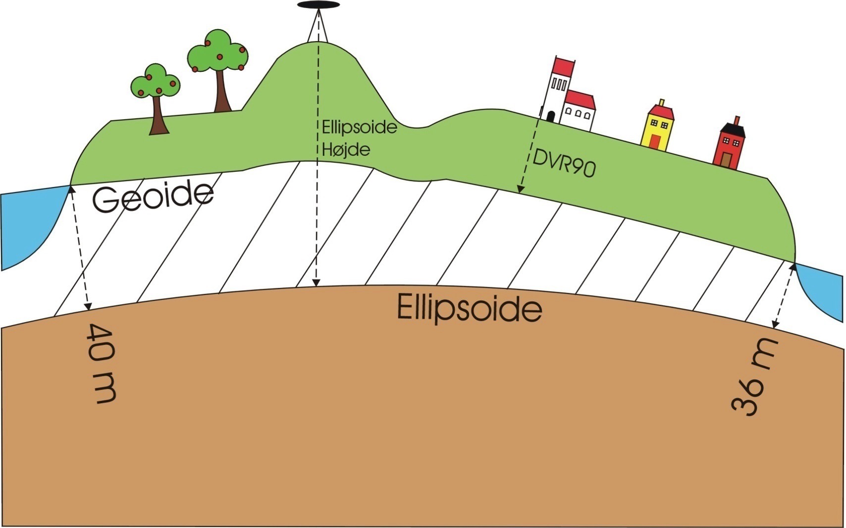
A vertical datum is a reference surface used as a baseline to measure elevations or depths on the Earth’s surface. It defines zero elevation and serves as a standard for measuring height (elevations) or depth (such as underwater depths). There are two main types of vertical datums:
-
Tidal Datum Dansk Normal Nul (DNN): A vertical datum used in Denmark based on mean sea level. It was historically used before being replaced by newer datums.
-
Geodetic Datum DVR90 (Danish Vertical Reference 1990): The current official vertical datum in Denmark, based on a precise geoid model.