Entity-based modelling is a method of modelling reality that focuses on discrete objects or so-called entities with a distinct presence in space. These entities are not just individual objects; they belong to specific types or classes that define their common properties and meanings.
For example, a building is an entity of the type “Building.” All entities within this type share certain properties, such as height, footprint, material, and function. These shared properties ensure that all buildings are represented consistently within the GIS, allowing for meaningful comparisons and analyses. Beyond properties, entities of the same type also carry a similar meaning within the context of a GIS project—each building, for instance, represents a structure used for shelter, work, or storage, contributing to the overall understanding of urban infrastructure.
Importantly, in an entity-based representation, two entities can share the same geographic location but represent different states or periods. For instance, a building that has been demolished and later replaced by a new structure at the same site would be represented as two distinct entities in the GIS. Each entity would carry its own attributes and class properties relevant to its time and purpose, allowing for temporal analysis and historical comparisons.
This classification into types or classes, along with the ability to handle multiple entities at the same location, is crucial for maintaining data integrity and consistency. It enables GIS systems to apply uniform rules to similar entities, ensuring that all buildings, roads, rivers, etc., are
As an example of Entity-based modelling, I have included 3 entities of the type building, each described by an image, its usage and the architect (images all generated by openAi)
| Image | Usage | Architect |
|---|---|---|
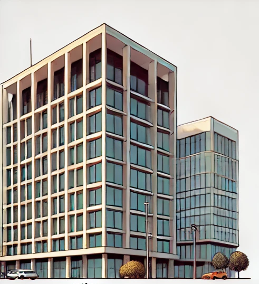 | Office building | le corbusier |
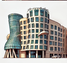 | Office/hotel | Frank Gehry |
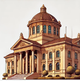 | Libary | Vincent Harris |