Field-Based Modelling
Field-based modelling is a method of modelling reality in GIS that focuses on continuous phenomena that vary smoothly across space. Unlike entity-based modelling, which deals with discrete objects, field-based modelling is concerned with aspects of reality that cannot be easily divided into separate units but instead exist as continuous fields.
In field-based modeling, the world is viewed as a series of fields where each field represents a specific phenomenon that varies over space. Examples of such fields include elevation, temperature, soil moisture, and air quality. These fields are conceptualized as having a value at every point in space, which means that the phenomenon is not confined to discrete objects but is spread out continuously across the landscape.
Field-based models are particularly useful in environmental science and resource management, where understanding the gradual changes and variations of a phenomenon across a landscape is crucial. For instance, the elevation of a terrain does not abruptly change from one point to the next; rather, it varies smoothly, creating a continuous surface that can be modeled and analyzed to understand slopes, watersheds, and other terrain features.
Properties of Field-Based Models
-
Continuity: The most defining characteristic of field-based models is that they represent phenomena that change continuously over space. Each location in the field has a value, and neighboring locations typically have similar values, reflecting gradual changes.
-
Non-discreteness: Unlike entities in entity-based models, which are discrete and clearly defined, fields do not have distinct boundaries. Instead, they cover the entire study area, with values changing gradually.
-
Interdependence: In field-based models, the value of the phenomenon at one location is often dependent on the values at nearby locations. This spatial interdependence is key to understanding and modeling the field accurately.
Examples of Field-Based Modeling
To illustrate field-based modeling, here are three examples of fields, each described by an image, the phenomenon it represents, and its application in GIS
| Image | Phenomenon | Application |
|---|---|---|
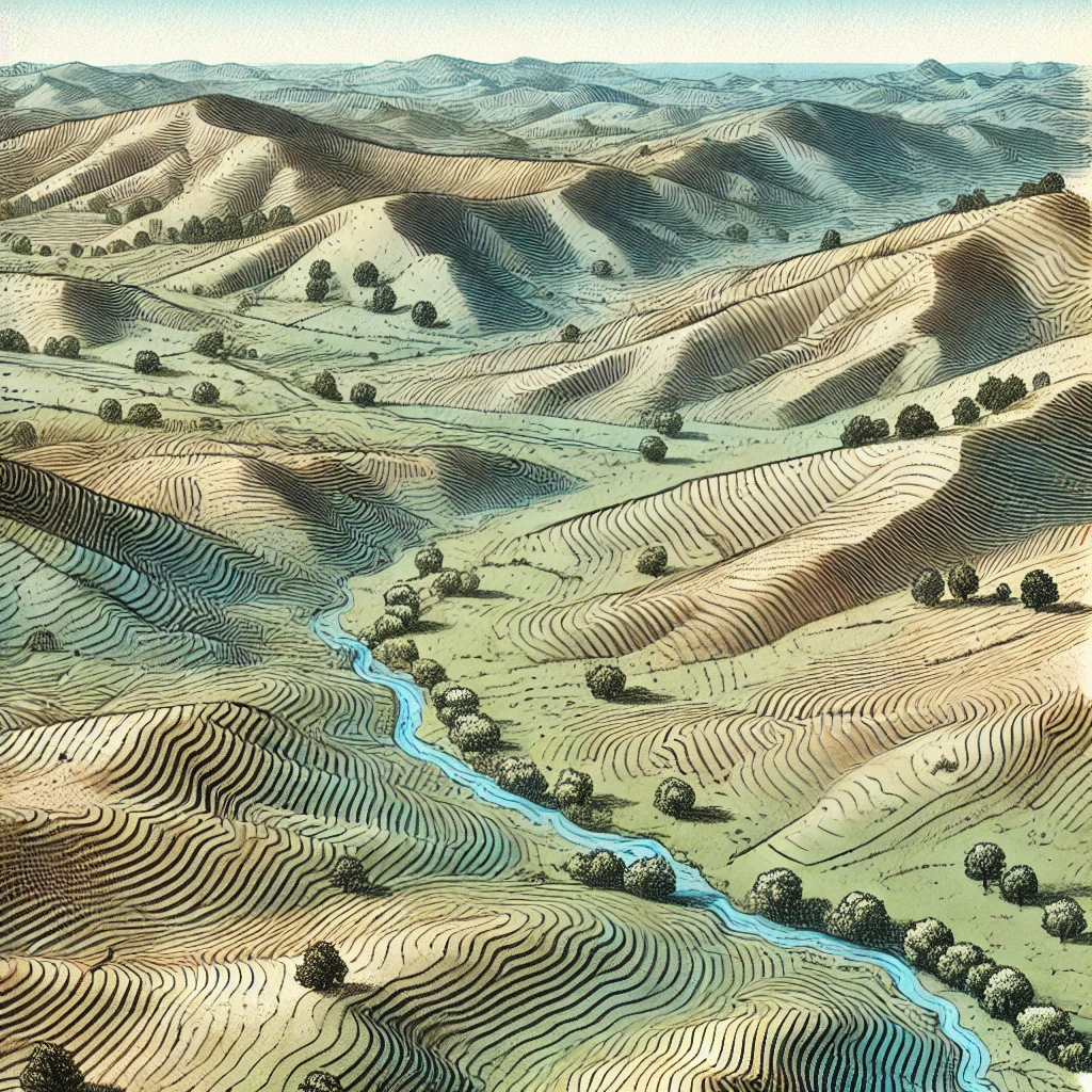 Images generated by OpenAI Images generated by OpenAI | Elevation | Terrain analysis |
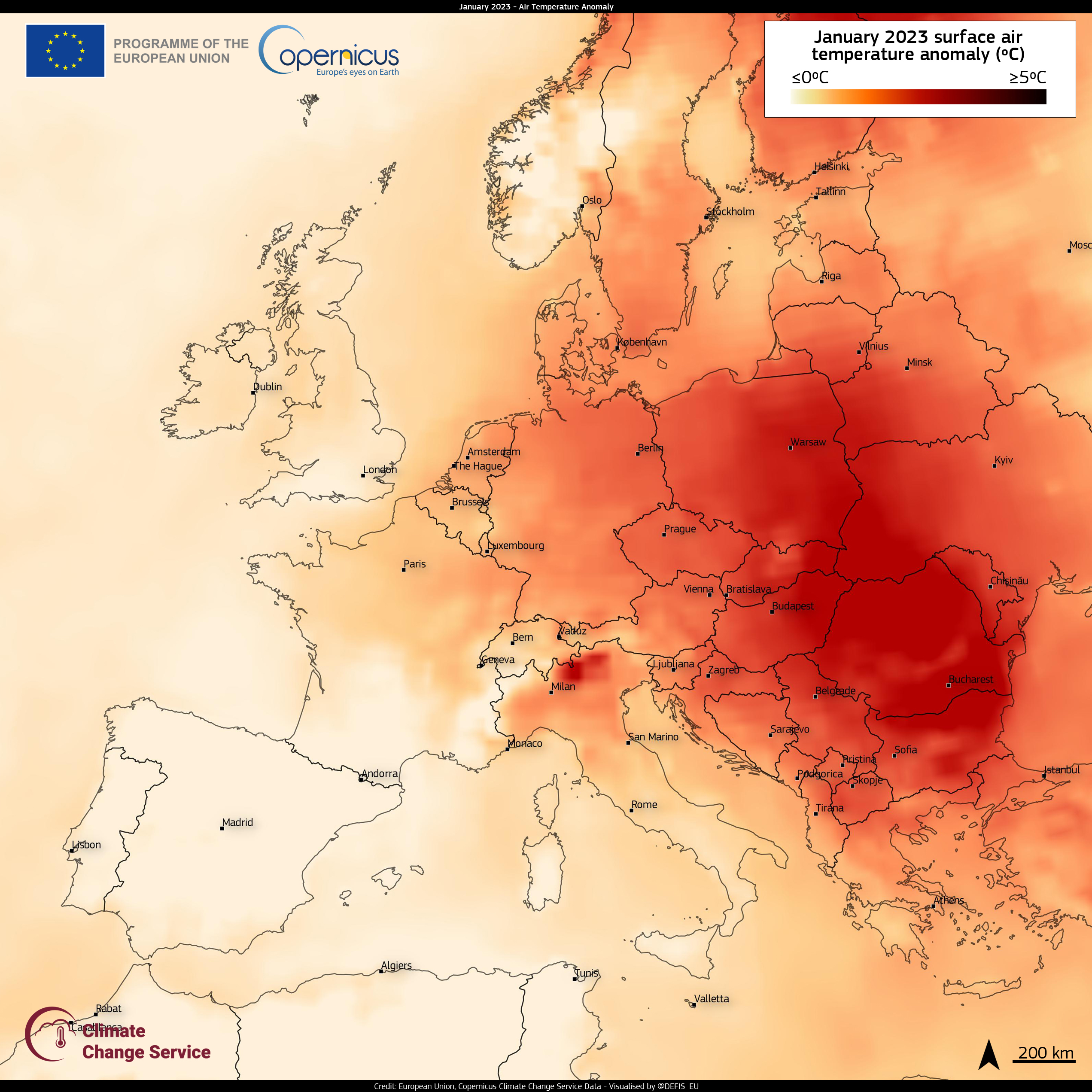 Credit:European Union, Copernicus Sentinel magery | Temperature | Climate modeling |
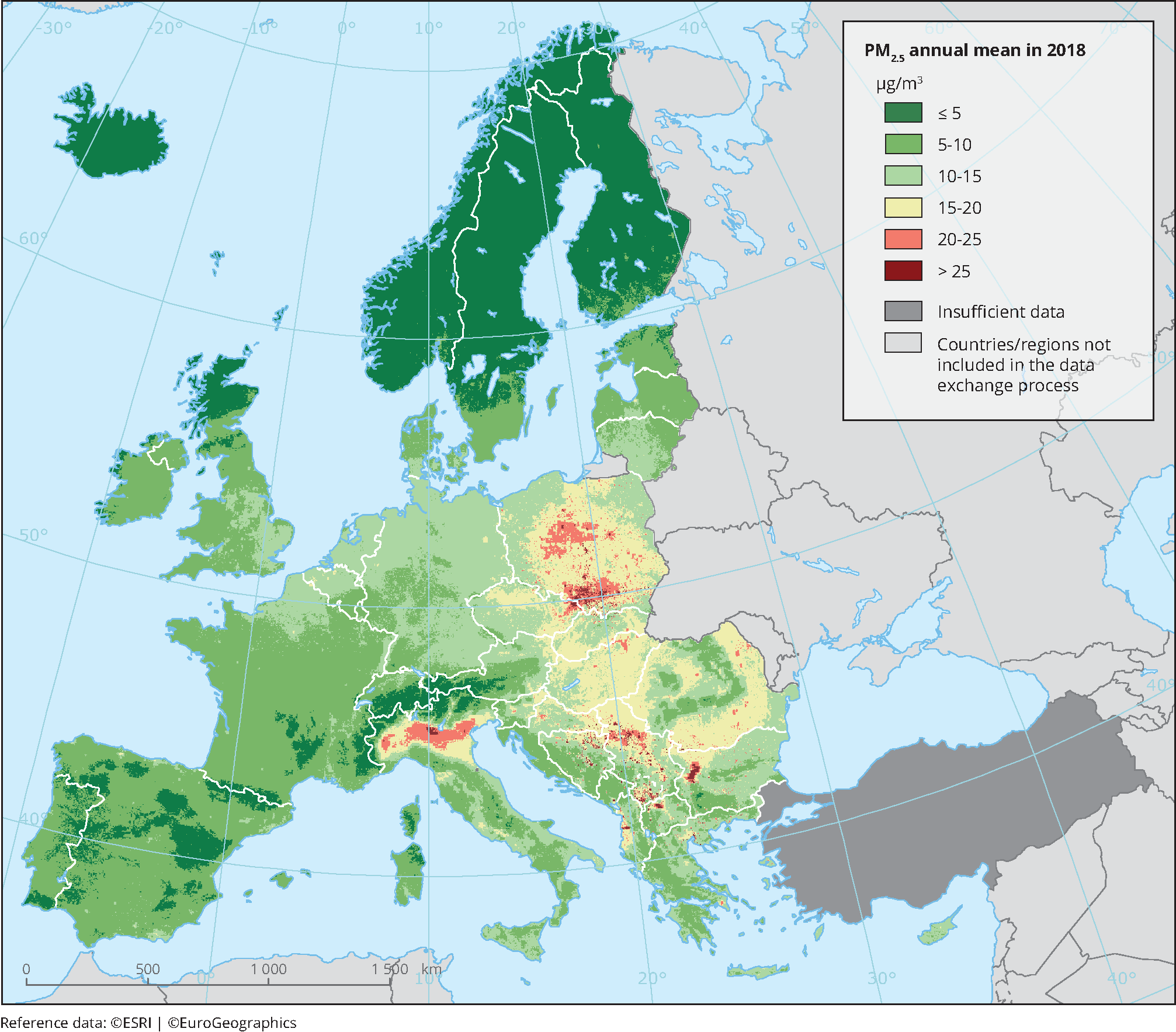 Credit: European Environment Agency (EEA). Credit: European Environment Agency (EEA). | Air Quality | Environmental health |
Field-Based Modeling in Practice
In practice, field-based models are often implemented through various interpolation techniques that estimate values at unsampled locations based on nearby sampled points. While the data might be collected at discrete locations (e.g., weather stations), the field model allows for the creation of a continuous surface that represents the phenomenon across the entire study area.
This approach is essential in GIS applications that require an understanding of how a phenomenon varies across a landscape, such as predicting temperature changes, analyzing pollution dispersion, or managing water resources.